Create Successful Maps
A good map is defined as having near perfect coverage and high quality.
However, sometimes regions might be missing or results are distorted. Creating maps from imagery is a photogrammetry process which can be a bit tricky to predict. In a way, it's more art than science.
Understanding the process
Each image has "features", or recognizable items such as corners, buildings, trees, cars, etc.
By taking overlapping images, these features can be tracked and matched across images. This process can sometimes fail and the result is either a processing error or bad quality results.
Below are recommendations to achieve best results.
Fly Higher
Fly at the optimal altitude for your desired target resolution. Don't fly lower than you absolutely need to. Higher elevation enhances feature matching, reduces distortion near building edges, and allows for greater image overlap and coverage. It also reduces the data capture time.
Fly on Overcast Days
Whenever feasible, fly in cloudy conditions. Clouds scatter sunlight, yielding soft lighting that minimizes blurriness, shadows, and enhances color quality.
Fly Between 10am and 2pm
When the sun is directly overhead, there will be less shadows and more even lighting.
Increase Overlap
More images means more matches between images.
Fly on Calm Days
Strong winds can make it challenging for your drone to stabilize the camera, resulting in blurrier images.
Hover While Taking Images
For drones with rolling shutter cameras (common in consumer-grade drones), direct the flight controller to hover before capturing an image to improve reconstruction accuracy. This isn't as much of a concern with drones using global shutter cameras.
Common Problems
Motion Blur
This indicates either an inadequate shutter speed or excessive flight speed. The optimal solution is to enhance the shutter speed, though flying at a slower pace or greater altitude can also mitigate the issue.
Out of Focus Camera
Ensure autofocus is enabled, and check for any lens dust or particles.
Vignetting
Vignetting results from insufficient light. Flying again at a brighter time of the day can alleviate this issue.
Insufficient Overlap
Low overlap can make it difficult for the software to find sufficient matches between images.
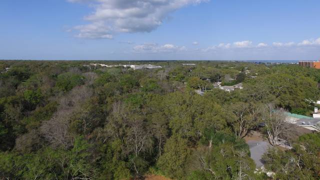
Horizon Images
Incorporating the horizon can distort the map distance. The software will prioritize distant areas, rather than the immediate area of interest below. Avoid images of the horizon.
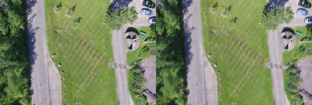
Low Altitude Images
Taking images at a low altitude can result in blurry/distorted results.
Featureless Images
Images of water, sand, snow and uniform crop fields have little color variation and few distinguishable patterns. They can be difficult to reconstruct. See image capture for guidelines on capturing some of these types of terrain.