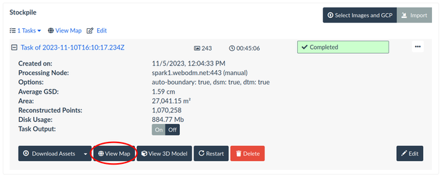
Calculate Volumes
You can use WebODM Lightning's cloud interface to calculate the volume between a base surface and a digital surface model (DSM). Both cut (above the base) and fill (below the base) volumes are supported.
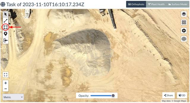
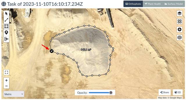
Create a Volume Measurement
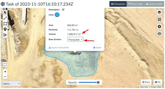
Volume Outputs
| Metric | Description |
|---|---|
| Cut | Volume above the base surface |
| Fill | Volume below the base surface |
| Volume | Cut + Fill |
Base Surface
The definition of the base surface can be calculated using one of several methods, listed below:
| Method | Description | Best When | Default |
|---|---|---|---|
| Triangulate | Points are triangulated and a surface is linearly interpolated from the results of the triangulation | Bounds of the stockpile are visible and surface is mostly flat | ✔️ |
| Plane | Fits a plane that is minimally distant from all points | Bounds of the stockpile are visible and surface is hard (e.g. cement), sloped or flat | |
| Average | A plane with height set to the average height of all points | The surface is relatively flat, but with some variation (averaging helps smooth out variation) | |
| Highest | A plane with height set to the maximum height of all points | Calculating fill volumes of containers or enclosures (e.g. swimming pools) | |
| Lowest | A plane with height set to the minimum height of all points | Bounds of the stockpile are not visible (e.g. hidden by a wall) | |
| Custom | A plane with height set to a custom value | The base surface elevation needs be manually specified |
Exporting Results
Press the Export to GeoJSON button to export the volume calculation in GeoJSON format.
Accuracy
With proper data capture, GCPs and when GSD is ~1 cm / pixel, the expected accuracy should be within 1-2%.
Field Planning
The use of Ground Control Points is recommended as well as following all guidelines for creating successful maps with a target GSD of 1 cm / pixel.
For the flight pattern, stockpile measurement tasks typically do not require a crosshatch pattern or an angled gimbal, due to the natural inclines of stockpile materials. Only in certain cases, such as when erosion creates steep angles on the stockpile, would a crosshatch flight pattern and angled gimbal improve results.